
Soils Survey Maps
The following link will take you to the US Department of Agriculture's Soil Survey Map Web Site. In the "Address Tab" under the "Quick Navigation" pull down tab on the left of the screen - you can type in the FULL address of the property you want to examine and the site will zoom to that address. Also, under this same "Quick Navigation" pull down tab on the left you can use the select "State and County" pull down tabs to access your county, then click on the "View" button. When your county appears on your screen, click on the zoom button to zoom in and "hand" button to pan left and right around the map to target the area you want examine.
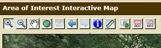
Look for a very small AOI tool button at the top of the map with a small red rectangle polygon symbol on top. Look under the Area of Interest Interactive Map Legend at the top border (See the screen clip below). It's the second AOI button from the right:
Look for a very small AOI tool button at the top of the map with a small red rectangle polygon symbol on top. Look under the Area of Interest Interactive Map Legend at the top border (See the screen clip below). It's the second AOI button from the right:
You will need to click on the AOI tool button then use your curser to draw a box over the area you want to see soil mapping information. Once the box appears on your screen, click on the "SOIL MAP" tab and the soil mapping information will appear in the box/area you selected. Use the "Clear AOI" tool button on the right menu to clear the soil mapping overlay box - so you can target another site.